Check out this incredible satellite image taken from Seasonality of Super Typhoon Ioke. Ioke is the strongest typhoon in recorded history to form in the central Pacific Ocean, with sustained winds of 160 mph and gusts up to 185 mph. That yellow dot in the middle of the storm is Wake Island, a territory of the U.S. The storm surge was supposedly going to completely engulf the island, so all 200 people who live there were evacuated and flown out to Hawaii.
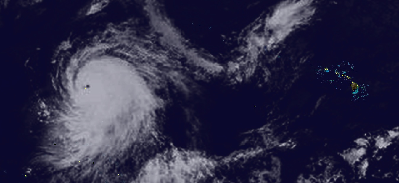
It’s rare to see such a large storm with a organized center “eye” like this. Click on the image to get a larger view that shows a reference of where this is taking place. If you are wondering if Hawaii is at risk, don’t, because the storm is heading in the opposite direction. It is projected to weaken to the equivalent of a category 3 hurricane by next Tuesday, still in the middle of the Pacific.
NASA has a really nice shot up on their MODIS Rapid Response Gallery. If you haven’t been there before, they have some really cool high-resolution shots available (250 meter pixel resolution!) from the MODIS instruments aboard Aqua and Terra (both polar orbiting birds).
Cool, thanks for posting those links. That first MODIS shot is amazing!
Absolutly amazing.